In my career, I’ve encountered compatibility gaps between field controllers and office software that turned a simple day of data collection into a week of manual re-formatting. The efficiency of a project doesn’t just depend on the hardware; it’s the surveying software that bridges the gap between raw measurements and final deliverables. Whether you are handling a total station data collection or complex point clouds, your software stack must prioritize interoperability.
Field Collection Software: What to Demand from Your Controller App
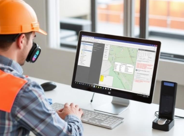
When evaluating field survey software, the primary goal is a clean, intuitive interface that reduces errors under the sun. I have found that tools like Trimble Access or Leica Captivate are benchmarks because they offer robust road staking and boundary survey modules. However, you must be wary of hardware lock-in; some GNSS controller software is designed to only function within its own brand ecosystem.
| Field Software | Compatible Office Suite | Primary Workflow |
| Trimble Access | Trimble Business Center (TBC) | General Survey, Roads, Monitoring |
| Leica Captivate | Leica Infinity | BIM, Scanning, High-Precision |
| Topcon Magnet | Magnet Office | Construction, Earthworks, GIS |
Office Processing: Connecting Field Data to Deliverables
The real “magic” happens during point cloud post-processing and raw data adjustment. A professional land survey software package should handle diverse file formats like .job, .dc, and .raw without losing metadata. From my experience, a smooth field-to-office workflow is one where the office technician can see the field notes and photos attached to every point in the survey data processing software without opening a separate email.
5-Step Process for Migrating Your Software Stack
- Audit Current Hardware: List all controllers and sensors to ensure the new surveying software supports existing drivers.
- Format Verification: Confirm the software can export the specific CAD or GIS formats your clients require.
- Cloud Integration Test: Set up a trial sync to see how the software handles data transfer over cellular networks.
- Training Evaluation: Calculate the time needed for your crew to master a new interface.
- Pilot Project: Run a small, non-critical project in parallel with your old system to catch “translation” errors.
Software Stack Decision Framework
Before committing, ask if the platform supports a hybrid environment. The best surveying software catalogue options are those that allow you to mix and match hardware brands as your company grows.
Expert Tip: Watch out for hidden costs in surveying software subscriptions. Many vendors have moved away from perpetual licenses, meaning if you stop paying the annual fee, you may lose access to your project data in the cloud. Always keep a local, vendor-neutral archive of your raw data.
Expert Tip: Watch out for hidden costs in surveying software subscriptions. Many vendors have moved away from perpetual licenses, meaning if you stop paying the annual fee, you may lose access to your project data in the cloud. Always keep a local, vendor-neutral archive of your raw data.
Expert Tip: Watch out for hidden costs in surveying software subscriptions. Many vendors have moved away from perpetual licenses, meaning if you stop paying the annual fee, you may lose access to your project data in the cloud. Always keep a local, vendor-neutral archive of your raw data.