Discover how satellite data is transforming environmental intelligence through AI, cloud computing, and real-time monitoring for smarter global decision-making.
Environmental challenges are becoming increasingly complex. Climate change, deforestation, pollution, urban expansion, and natural disasters are creating massive pressure on governments, researchers, and businesses worldwide. To manage these challenges effectively, organizations need accurate, real-time, and data-driven insights. This is where environmental intelligence plays a critical role.
Environmental intelligence refers to the collection, analysis, and interpretation of environmental data to support smarter decisions. Modern satellite systems have become one of the most powerful tools driving this transformation. From monitoring forests and oceans to predicting weather events and tracking agricultural patterns, satellite technology is reshaping how humans understand and protect the planet.
The rapid advancement of AI, cloud computing, and big data analytics has further expanded the capabilities of satellite-based monitoring systems. Today, environmental intelligence is not only helping scientists and governments but also empowering businesses, investors, and technology innovators to make more informed decisions.
Understanding Environmental Intelligence
Environmental intelligence combines data science, geographic analysis, remote sensing, and predictive modeling to generate actionable environmental insights. The goal is to turn massive amounts of raw environmental information into meaningful intelligence that supports planning, sustainability, and risk management.
Governments use environmental intelligence for disaster preparedness and climate monitoring. Agricultural industries rely on it to optimize crop yields and water usage. Insurance companies use environmental data to assess climate-related risks. Financial institutions also analyze environmental patterns to understand the economic impact of climate events.
In fact, the growing importance of economic data has made environmental intelligence even more valuable because environmental changes directly influence global supply chains, energy markets, agriculture, tourism, and infrastructure investments.
The ability to monitor environmental conditions in real time has become essential for both economic stability and long-term sustainability.
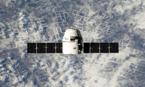
The Growing Power of Satellite Data Technology
Satellite systems have evolved far beyond traditional weather forecasting. Modern satellites collect enormous volumes of data about the Earth’s atmosphere, land surfaces, oceans, forests, and urban environments. These systems can capture high-resolution imagery, thermal information, moisture levels, pollution indicators, and climate patterns across the globe.
The rapid evolution of satellite data technology has dramatically improved the accuracy and speed of environmental analysis. Advanced satellites now provide continuous monitoring capabilities that allow organizations to detect environmental changes almost instantly.
For example, satellites can identify illegal deforestation activities within hours, monitor glacier melting patterns over time, and track air pollution in major cities. This level of visibility was nearly impossible just a few decades ago.
The combination of satellite imagery and AI-powered analytics is also making predictive environmental modeling far more effective. Scientists can now forecast floods, droughts, wildfires, and severe storms with greater precision, helping communities prepare earlier and reduce damage.
How Satellite Monitoring Systems Support Climate Protection
Climate change is one of the biggest reasons why satellite monitoring has become increasingly important. Environmental threats are expanding rapidly, and traditional monitoring methods alone are no longer sufficient.
Modern satellite monitoring systems provide continuous observation of forests, oceans, glaciers, rivers, and agricultural land. These systems help organizations identify environmental threats before they become catastrophic.
Forest and Wildfire Monitoring
Satellite systems can detect illegal logging activities, monitor forest degradation, and identify wildfire risks in real time. Thermal imaging technologies help authorities identify heat anomalies before wildfires spread uncontrollably.
This information allows governments and environmental organizations to respond faster and allocate resources more efficiently.
Water and Ocean Analysis
Satellites are also helping researchers monitor ocean temperatures, coral reef health, sea-level rise, and water pollution. Changes in ocean conditions directly impact fisheries, tourism, biodiversity, and coastal communities.
Environmental intelligence generated from satellite data supports sustainable ocean management and disaster prevention strategies.
Agricultural Intelligence
Farmers and agricultural companies increasingly rely on satellite insights to improve crop productivity. Satellite imagery helps monitor soil conditions, irrigation needs, crop health, and weather patterns.
Precision agriculture powered by environmental intelligence reduces water waste, improves yields, and lowers operational costs.
Artificial Intelligence and Emerging Technologies Are Accelerating Innovation
Satellite data alone is valuable, but its true power emerges when combined with advanced analytics and artificial intelligence. Modern environmental systems process enormous volumes of information that would be impossible for humans to analyze manually.
This is where AI, machine learning, IoT devices, and predictive analytics become essential.
Many of the world’s most innovative technologies are now focused on improving environmental monitoring and automation. AI algorithms can identify environmental anomalies, predict climate risks, classify satellite imagery, and automate large-scale environmental reporting.
For example, machine learning systems can analyze satellite images to detect changes in vegetation patterns, monitor urban expansion, and identify environmental degradation. AI-powered predictive models can also forecast extreme weather events more accurately by combining historical climate data with real-time satellite observations.
The Internet of Things (IoT) further enhances environmental intelligence by integrating ground-level sensors with satellite networks. This combination creates a more comprehensive and accurate understanding of environmental conditions.
These technologies are enabling faster decisions, better resource management, and more efficient sustainability planning across industries.
Why Data Infrastructure Matters in Environmental Intelligence
Environmental intelligence systems generate massive amounts of data every second. Processing satellite imagery, climate models, geographic data, and AI analytics requires scalable and high-performance infrastructure.
Without reliable cloud hosting and data management systems, environmental platforms would struggle to handle real-time analysis and global-scale monitoring.
Environmental startups, research institutions, and data analytics companies increasingly rely on cloud infrastructure providers to support their operations. Fast servers, scalable storage, reliable uptime, and distributed networks are critical for processing environmental data efficiently.
This is one reason why many technology-driven organizations choose platforms like Cloudways to manage high-performance cloud hosting environments. Scalable cloud infrastructure allows environmental intelligence platforms to process large datasets quickly while maintaining speed, reliability, and accessibility for users worldwide.
As environmental monitoring systems continue to expand, cloud infrastructure will remain a foundational component of global environmental intelligence networks.
Blockchain and Distributed Storage in Environmental Data Management
Environmental data must remain transparent, secure, and accessible. However, centralized storage systems can create challenges related to scalability, security, and data integrity.
This is why decentralized technologies are becoming increasingly relevant in environmental intelligence.
The rise of blockchain and distributed storage is opening new possibilities for managing environmental datasets securely and transparently. Blockchain technology can help verify environmental records, improve data traceability, and reduce the risk of manipulation.
For example, environmental organizations can use blockchain systems to verify carbon emissions data, track sustainability commitments, and maintain transparent environmental reporting systems.
Distributed storage systems also improve resilience by reducing dependency on centralized infrastructure. Since environmental intelligence often involves enormous datasets collected from satellites and sensors worldwide, decentralized storage solutions can improve scalability and long-term accessibility.
The integration of blockchain technology with satellite monitoring systems may become increasingly important as governments and businesses prioritize transparency and accountability in environmental reporting.
Environmental Intelligence in Smart Cities
Urbanization is rapidly transforming cities worldwide, creating new environmental challenges related to pollution, energy consumption, traffic congestion, and resource management.
Environmental intelligence is becoming a core component of smart city development. Satellite data helps city planners monitor urban heat islands, analyze traffic patterns, assess air quality, and optimize infrastructure planning.
AI-powered environmental systems can also support energy-efficient transportation networks, waste management systems, and sustainable urban development strategies.
Real-time environmental insights help city administrators respond faster to emergencies, improve public safety, and create healthier living environments for residents.
As smart cities continue to evolve, satellite-based environmental intelligence will become even more integrated into daily urban operations.
Disaster Response and Risk Management
One of the most valuable applications of environmental intelligence is disaster response. Natural disasters often develop quickly, leaving little time for preparation.
Satellite monitoring systems provide real-time visibility during floods, hurricanes, earthquakes, and wildfires. Emergency response teams can analyze satellite imagery to identify damaged areas, coordinate rescue operations, and allocate resources more effectively.
Environmental intelligence also improves long-term risk management. Governments and businesses can analyze historical climate data to identify vulnerable regions and strengthen infrastructure planning.
Insurance companies increasingly use satellite-based environmental data to assess property risks and improve catastrophe modeling.
These capabilities reduce economic losses and help communities recover faster after environmental disasters.
The Future of Environmental Intelligence
The future of environmental intelligence will likely be driven by automation, AI integration, and real-time predictive analytics. Satellite systems are becoming more advanced, affordable, and accessible, allowing organizations of all sizes to leverage environmental insights.
Future innovations may include autonomous satellite networks, AI-powered climate prediction systems, advanced digital twins of ecosystems, and global environmental data-sharing platforms.
Environmental intelligence will also become more interconnected with financial markets, public policy, and global sustainability initiatives. Investors and businesses are increasingly evaluating environmental risks alongside economic performance.
As environmental challenges continue to evolve, data-driven intelligence will become essential for building resilient economies and sustainable societies.
The organizations that successfully combine satellite monitoring, AI analytics, scalable cloud infrastructure, and decentralized data systems will be better positioned to lead the next generation of environmental innovation.
Conclusion
Satellite technology is transforming environmental intelligence in extraordinary ways. Real-time environmental monitoring, predictive analytics, AI-powered automation, and scalable cloud systems are reshaping how humans understand and manage environmental risks.
From climate protection and disaster response to agriculture and smart city development, environmental intelligence is becoming a critical foundation for modern decision-making.
As satellite capabilities continue to advance, businesses, governments, and technology innovators will gain even deeper insights into the planet’s changing conditions. The integration of AI, blockchain, distributed storage, and cloud infrastructure will further enhance the speed, transparency, and reliability of environmental data systems.
The future of environmental intelligence is not just about collecting more data. It is about transforming that data into actionable knowledge that supports sustainability, economic resilience, and smarter global decision-making.