NTRIP RTK subscriptions help field devices receive correction data through an internet connection, improving GNSS positioning beyond standard satellite signals. With the right receiver, antenna, mobile coverage, and open sky, teams collect much more accurate location data for outdoor work.
For survey crews, drone teams, and asset managers, RTKdata as an NTRIP provider supports practical field accuracy when coverage, receiver compatibility, and project requirements match. A reliable correction service helps teams spend less time on equipment setup and more time collecting usable location data.
Why Subscription Choice Matters
A subscription gives users access to correction streams from reference stations without placing a private base station on every jobsite. This reduces setup time, simplifies field planning, and supports more consistent results across wide service areas.
That need reflects the wider growth of GNSS-based work. In its 6th GNSS Market Report, the European GNSS Agency reported that global GNSS downstream market revenue from devices and services was forecast to grow from €150 billion in 2019 to €325 billion in 2029.
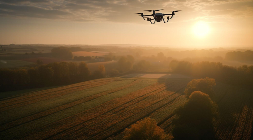
Drones and Industrial Sites
Drone programs and industrial facilities benefit when accurate position data supports mapping, inspections, repeated routes, and measurable site records. This matters most in yards, plants, ports, utility sites, and large outdoor campuses where teams need reliable spatial references.
Accurate site data also carries measurable economic value. According to USGS, the 3D Nation Study documented $13.5 billion in benefits across 1,352 mission-critical requirements for 3D elevation data.
Factory and Yard Mapping
Outdoor facilities need current maps of stockpiles, loading zones, vehicle lanes, equipment areas, and restricted spaces. Accurate flight positioning helps industrial drones in modern manufacturing connect aerial inspection with inventory control, layout planning, and maintenance records.
Industrial teams rely on corrected drone data for measurable site tasks:
- Stockpile volume checks
- Yard layout updates
- Roof and structure reviews
- Equipment position records
Utility Inspection
Utilities use corrected drone or rover positions near power lines, telecom towers, pipelines, solar farms, substations, and water infrastructure. Better coordinates help connect photos, defects, and field notes to the correct asset.
Accurate records reduce confusion during follow-up work. If a crew needs to repair a damaged bracket, inspect a tower section, or revisit a leak marker, precise location data makes the return visit faster.
Agriculture and Land Work
Agriculture, forestry, and environmental projects benefit from accurate positioning because land-based work repeats over time. Boundaries, rows, lanes, drainage lines, and field records become more useful when positions remain consistent.
Precision Agriculture
Farmers and contractors can use corrected positions for autosteer, planting, spraying, harvesting, field mapping, and drainage work. Repeatable routes reduce overlap, lower input waste, and improve operator consistency.
Precision farming gains the most value from tasks where accuracy affects cost and timing:
- Autosteer field passes
- Controlled traffic lanes
- Variable-rate applications
- Field boundary mapping
- Drainage and leveling work
Seasonal reuse increases the benefit. A reliable field boundary, lane plan, or drainage record supports future operations when machines return to the same area.
Forestry and Environmental Mapping
Forestry crews and environmental consultants use high-accuracy positions for sample plots, habitat records, erosion checks, planting zones, and boundary reviews. Reliable point data helps compare field conditions across different visits.
Rural work can bring tree cover, uneven terrain, and weak mobile service. Teams need to check coverage before deployment because real-time correction streams depend on a stable connection.
Construction, Surveying, and Public Assets
Construction crews, surveyors, and public agencies benefit when field positions match plans, asset databases, and inspection records. A statewide correction network shows how this works in practice: MnDOT’s MnCORS GNSS Network uses more than 140 receivers at known positions to provide survey-grade positioning corrections for public and private users across Minnesota.
Construction Layout

Contractors use corrected GNSS for staking, grade checks, excavation edges, road work, utility marking, and machine guidance. Accurate field points help crews compare real site conditions with design files.
Construction teams apply corrections to tasks that require repeatable positions:
- Grade checks
- Utility locations
- Road alignment points
- Excavation boundaries
Land Surveying
Surveyors use correction services for topographic points, control checks, as-built records, and boundary support where local standards allow. However, professional judgment remains essential because legal survey work needs documented methods and quality checks.
Municipal Asset Records
Cities and public works teams use accurate positions for road signs, drainage structures, hydrants, streetlights, sidewalks, trees, and utility features. Better location records make maintenance and asset searches easier. Public agencies also benefit when field updates connect with GIS records. Cleaner location data supports budgeting, repair planning, inspection schedules, and emergency response.
Real Value Across Industries
NTRIP RTK subscriptions are most useful where accuracy saves time, reduces rework, or improves records. Agriculture, construction, surveying, drones, utilities, public works, forestry, and industrial sites often see strong benefits.
A service should be selected based on coverage, correction quality, receiver support, technical help, and field conditions. When those factors fit the job, high-accuracy positioning becomes a practical tool for better outdoor operations.