Natural disasters happen all over the world each year. They cause many deaths and a lot of damage. But new research in geophysics could completely change things. Scientists use tools like GPS, satellite pictures, computer learning, and listening to earthquakes.
They look for patterns to predict when and where disasters will happen. If they can see early signs, they hope to make warning systems. These could give people time to get to safety before the next earthquake, flood, or wildfire. This could save many lives and property. With more work, geophysics could really improve how ready and robust we are against catastrophes.
What is geophysics?
Geophysics is the study of the physics and processes of the Earth. It explores the planet’s interior by taking measurements at the surface and then uses math models to predict the deep properties below.
Geophysicists focus on a few main areas. Seismology examines seismic waves caused by earthquakes to learn about the Earth’s large-scale structure and earthquake behavior. Geomagnetism studies the magnetic field around our planet. Geodesy looks at the gravitational field and shape of the Earth’s surface.
Experiments and modeling in mineral physics help deduce the mineral composition and density at various depths. Mathematical models are used to forecast big motions within the Earth, like tectonic plate movements.
What is geophysics used for?
Mining and exploration companies depend on it to pinpoint where valuable mineral deposits are hidden. Oil and gas explorers use it to hunt for underground reservoirs. Geothermal projects rely on it to locate heat sources for power generation. Hydrogeologists lean on it to map aquifers and groundwater. Environmental crews trust it to track contamination underground.
Archaeologists dig it to find ancient sites without disturbing them. Engineers love it for checking the stability of infrastructure like roads and buildings. Disaster experts applaud it for helping predict earthquakes, volcanic eruptions, and tsunamis.
Geophysicists can see the Earth without drilling by using cool methods like gravity, magnetic, electrical, and seismic surveys. This provides the vital intel needed for finding resources, harnessing energy, protecting water, conserving history, building safe structures, and keeping communities safe.
How can geophysics be used to predict natural disasters?
Geophysics allows us to peer into the inner workings of our dynamic planet, providing critical insights that can give advance warning of impending natural disasters. Geophysicists can detect patterns that may foreshadow catastrophic events by studying variations and fluctuations in the Earth’s magnetic, gravitational, electrical, and seismic activity.
From subtle tremors foretelling destructive earthquakes to magnetic anomalies hinting at impending volcanic eruptions, these subsurface signals, properly interpreted, can save countless lives. Some real-world examples demonstrate the life-saving potential of using geophysical techniques to predict natural calamities before they occur.
Seismology
Seismology looks at earthquakes and how the Earth’s tectonic plates move around. By keeping track of seismic activity, scientists can spot patterns that help predict when and where the next big shaker will hit.
This info lets people get prepared ahead of time. They use seismic stations to analyze earthquake waves and determine quakes’ location and strength. GPS tracks tiny crust movements caused by quakes, giving clues to strain buildup along fault lines. And they measure stress in the crust to see when and where future quakes will probably happen.
Volcanology
Volcanology studies volcanoes and the threats they can cause. By watching what volcanoes are up to, scientists can catch early signs of eruptions, like earthquake changes, gas emissions, and ground shape. This allows them to warn people to evacuate dangerous areas.
They monitor volcanic gases like sulfur dioxide to detect changes that mean an eruption could be coming soon. Ground sensors track subtle volcano shape changes from magma movement. And seismic networks detect rumblings linked to volcanic activity.
Hydrology
Hydrology examines water flow above and below the surface. Keeping tabs on things like rainfall, river levels, and groundwater gives insight into potential floods and droughts. Networks collect hydrological information for review.
Flood forecasting models use this data to predict when, where, and how bad flooding could be. Scientists monitor moisture, vegetation, and water levels to evaluate how severe and long-lasting droughts may be.
Some real examples of natural disaster prediction
Geophysics allows us to detect early signals of impending natural disasters. Scientists can now reliably predict catastrophic events like earthquakes and eruptions by monitoring subtle changes in the Earth’s seismicity, gravity, magnetics, and ground deformation around active faults and volcanoes.
Let’s look at some real-world examples demonstrating the life-saving potential of using geophysical techniques to forecast these destructive forces of nature before unleashing their fury.
Monitoring seismic activity at Mount St. Helens in 1980 allowed scientists to predict its disastrous eruption on May 18 of that year. They detected increased earthquake swarms and ground deformation that indicated rising magma. This allowed authorities to evacuate the area, saving lives.
InSAR satellite data detected ground deformation before the 2018 eruption of Kīlauea in Hawaii, allowing vulcanologists to issue warnings. The eruption destroyed over 700 homes, but precautions prevented loss of life.
Analysis of tiny magnetic fluctuations associated with underground water and magma movements enabled Japanese scientists to issue an earthquake warning minutes before the deadly 2011 M9 Tōhoku quake and resulting tsunami. This allowed many to reach safety.
Gravity measurements indicating the rapid loss of underground mass beneath Bayou Corne, Louisiana, provided evidence of an impending sinkhole. This allowed surrounding areas to evacuate before the 20-acre sinkhole opened in 2012.
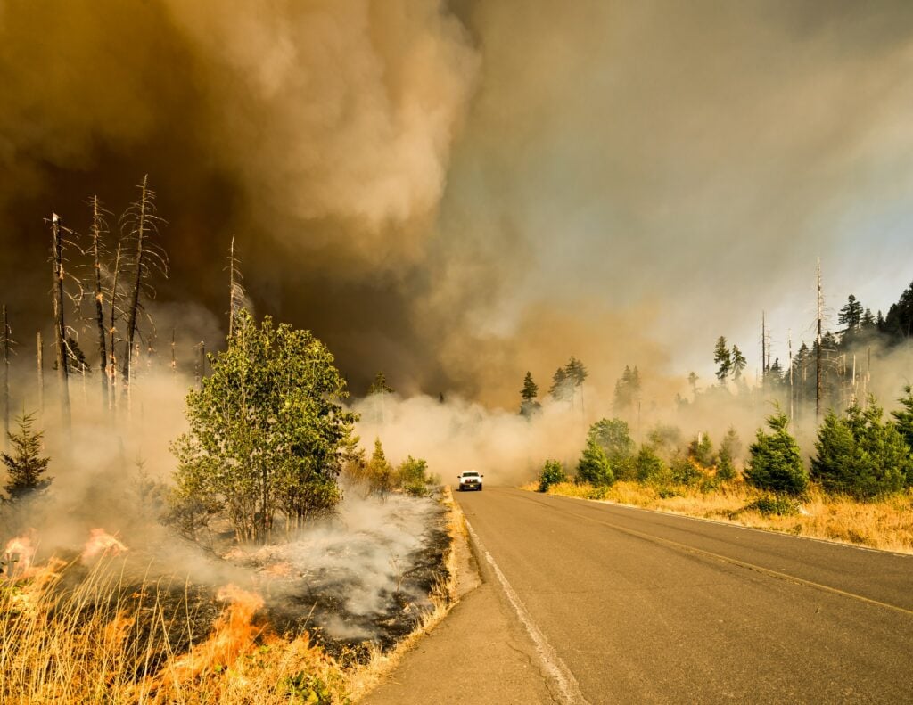
Wildfire monitoring systems like FIRESENSE detect spikes in soil and surface temperatures using infrared sensors. This allows firefighting agencies to deploy resources to high-risk areas early before fires become uncontrollable.
Understanding the challenges
There are many challenges when it comes to using geophysics to predict natural disasters, such as interpreting complex seismic and volcanic activity and modeling intricate geophysical systems.
Data interpretation has inherent uncertainties
Complex geology and limited spatial coverage make it tough to differentiate signals from noise. Small seismic events could mean magma or plate movements. Figuring out the cause takes some really careful looking.
Interconnected processes make modeling complicated
Volcanic eruptions involve underground, atmospheric, and whole Earth system interactions. Recording all those connections accurately enough to predict eruptions pushes what our current models can do.
There needs to be more monitoring networks
Sparse, broken, or weather-damaged sensors leave holes in the data we need. This weakens how well we can make predictions. Expanding coverage is pricey.
Communicating uncertainty to people
Managing public expectations around things like precision and probabilities with geophysics predictions helps people respond appropriately when emergencies happen.
Summing up
Geophysics has huge potential for giving us a heads-up about impending natural disasters. By peering into our restless planet, geophysicists can spot early trouble signs, like shakes, jolts, and jumps, that provide advance warning of earthquakes, eruptions, floods, and more. This life-saving insight comes from monitoring seismicity, gravity, magnetics, ground movement, and other geologic processes for changes.
Of course, prediction still has big challenges ahead. Our Earth is complex. Monitoring networks need expanding. Communicating forecast uncertainty requires care. But can you say, “Here’s what might be coming!” before catastrophe strikes? That’s progress worth pursuing.
So, let’s keep collaborating to advance prediction capabilities worldwide. The goal? Making our dynamic Earth’s rumblings and grumblings a little less surprising and a lot less deadly in the years ahead.