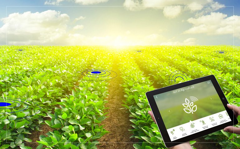
Geographic information system (GIS) software is a specially designed tool used for storing, capturing, retrieving, analyzing, and displaying georeferenced information and spatial data. GIS software is widely used in agriculture as the crops are location-based. GIS plays a crucial role in the overall production of crops. This software puts field data to work for maximizing crop yield, reducing overall expenses, and mitigating damage from natural disasters. GIS in agriculture also helps in crop health monitoring, livestock monitoring, insect and pest control, irrigation control, along with farming automation. EOS Data Analytics (EOSDA), a satellite imagery analytics provider, announced the launch of the first agriculture-focused satellite constellation into low Earth orbit by 2024. One of the key objectives of the new satellite constellation will be monitoring farmlands and addressing global challenges, environmental threats, climate changes, and land degradation.
The agricultural sector across the globe has rapidly evolved over the recent years. Farmers around the world are adopting various advanced techniques for improving product yield and reducing water wastage. They have steadily started using precision agriculture to reduce the number of fertilizers applied in the field. In addition, the use of drones and satellites has drastically increased over the past few years. Many farmers are using satellite technology to collect real-time data and information about soil for predicting crop production and monitoring drought and flooding. One of the most important functions of GIS and mapping is it allows the user to visualize, analyze the data and evaluate which crops are flourishing, the extent to which the natural disasters and pollution affect the crop production, and control the use of pesticides and fertilizers.
Factors such as rising demand for GIS software for real-time mapping, increasing awareness about the importance of precision farming, and growing demand for high-quality food and crops are expected to drive global market revenue growth over the forecast period. In addition, rising usage of satellite and drone technology for effectively managing and monitoring soil and land conditions and increasing investments for developing more advanced software are other factors expected to drive global market growth going ahead. However, factors such as high initial investments, dearth of skilled professionals that can operate advanced GIS software, and the unwillingness of some farmers especially from developing economies to use these advanced systems can hamper revenue growth of the global market to a certain extent during the forecast period.
Increasing awareness regarding food insecurity and the need for precision farming to reduce costs and expand crop yield are some key factors driving market revenue growth
The global Geographic Information System (GIS) software in the agriculture market size reached USD 4.04 Billion in 2020 and is expected to register a revenue CAGR of 12.8% during the forecast period, according to the latest analysis by Emergent Research. Increasing awareness regarding risks due to food insecurity and the increasing need for precision farming are key factors projected to support market revenue growth between 2021 and 2028. In addition, increasing demand for GIS software for real-time mapping will boost revenue growth of the market. Water availability and management are major issues in agriculture, and better real-time land data is important in solving this problem. GIS software provides a smart solution to the problem. Drones and satellite images can effectively manage and monitor soil and land conditions. GIS software entails the use of Soil Moisture Ocean Salinity (SMOS) and monitors vegetation growth using Landsat imagery and Normalized Difference Vegetation Index (NDVI), and others, to analyze crop productivity, monitor drought conditions, and potential of flooding.
However, the lack of skilled professionals to manage GIS software is a key factor expected to hamper market revenue growth to some extent during the forecast period. In addition, reluctance among some farmers, especially in developing economies, to continue to prefer traditional agriculture practices is expected to hamper the market growth.
Some major companies in the global market report include Oracle Corporation, Hexagon AB, Autodesk Inc., Takor Group Ltd, Trimble Inc., Topcon Corporation, SuperMap Software Co. Ltd., Parrot SA, Earth Observing System (EOS) Data Analytics Inc., and Geosoft Inc.
To get leading market solutions, Visit the Link

![Discover proven portfolio optimization strategies for Saudi investors in 2026. Learn how to diversify, rebalance, and grow your wealth with expert guidance from Insightss.]](https://techbullion.com/wp-content/uploads/2025/03/Screenshot-2026-07-20-171633-300x180.png)
![Discover proven portfolio optimization strategies for Saudi investors in 2026. Learn how to diversify, rebalance, and grow your wealth with expert guidance from Insightss.]](https://techbullion.com/wp-content/uploads/2025/03/Screenshot-2026-07-20-171633-80x80.png)