When you think of historical research, do you ever wonder how it was done without using Information Technology? Well, today we are going to meet someone who helps answer those questions and how his project is bringing a revolution for historians and many diverse group of people. Kohei Otsuka founded Code for History and one of his main initiatives is Maplat an open-source map platform that allows users access to educational tourism resources while preserving value in these historic documents created centuries ago.
Meet the founder
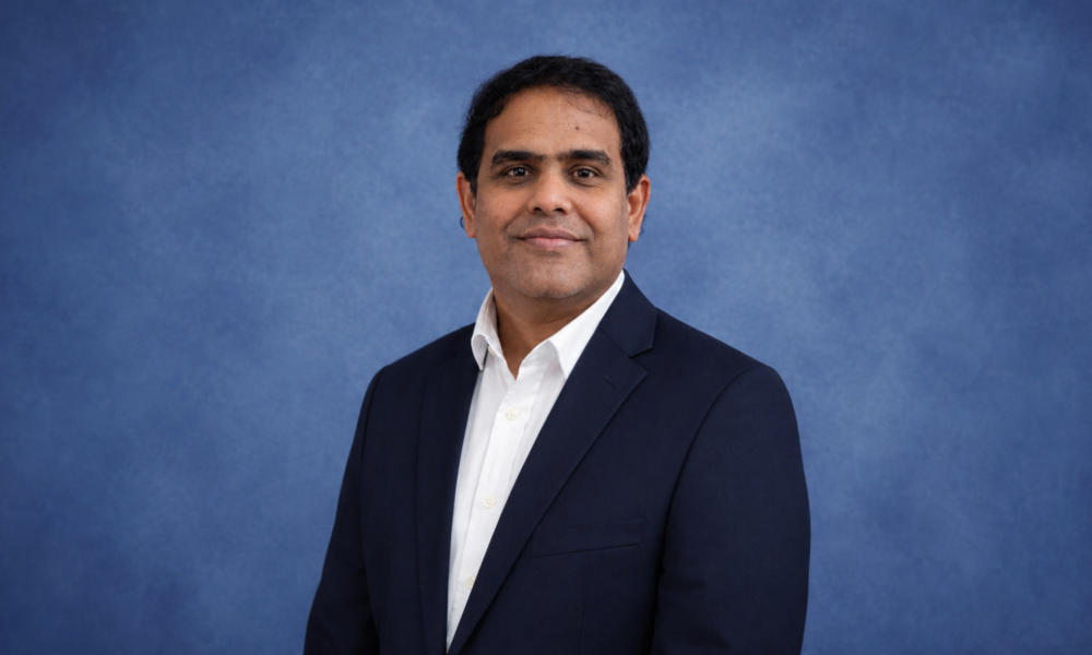
Growing up near Himeji Castle, 51-year-old Kohei Otsuka developed an interest in World Heritage Sites and history. Growing up near where it all began has helped shape who he is today but not without some influence from his dad who was a civil engineer. His father influenced him to choose telecommunications engineering as a major. He recalls that he was more interested in the lectures on historiography than in specialized research.
“In my private life, I volunteered in the recovery from the Great Hanshin-Awaji Earthquake and in literacy education for those who had no access to education due to social problems. These experiences as a student, covering many topics and subjects may have been the roots of my later interest in issues at the boundaries of various fields.” Kohei shares.
The bumps along the way
“Around 2012, I had nothing but despair after my old map application business, which I had planned to devote my life to, was taken away from me, along with all its technology.
I realized that the idea for the ultimate technology to handle old maps was still in my head. If I had been fired by the irrational company after I had formed the idea within the company, I would have been in despair, but fortunately I was forced to quit before I could formulate the ultimate idea, and I realized that if I could formulate it on my own, I could rewind enough to get back on track. My idea was impossible to implement with my technical capabilities at the time, but Maplat was successfully implemented over the next four years, in 2015.”
The story of his life was changed forever around 2012 when let go of by a company (a research institute’s subsidiary) that took the old map application business and the technology. He had cultivated this business through his inventions and patents but was harassed mercilessly. Fortunately, he was fired before the completion of the project, and later he took the idea and worked on it on his own, and the result was the ultimate technology of Mapalt.
The fun of moving people and the economy through location-based games inspired him to start working on technology using old maps more than a decade ago.
Maplat was successfully implemented in 2015, This project posed many technical challenges, but they were not insurmountable. In fact, the technology used was more powerful than what was available.This new technology developed by Kohei uses a mathematically intrinsic approach which essentially solves many of the issues that the old technology faced.
Awards and Current Deployment
Kohei made history in 2018 by winning a triple crown at the GSI (Geospatial Information Authority of Japan) contest – the headquarters for Japanese mapping technologies!
The use of map-based technology in education and tourism has led to its adoption by several universities including the University of Tokyo and Ritsumeikan.
The bus and train location system utilizing pictorial maps was also implemented for Toyohashi City’s smart city applications, demonstrating its potential as a go-anywhere solution that can be used by residents and visitors alike!
The Rise of Code for History
“Code for History initiative started in 2018 as a way to contribute to historical research using IT. The aim is to develop software to solve problems in the field of historical research, such as the existence of stone cultural properties on street corners.
Under the Code for History name, we will continue to innovate in the field of historical research, with Maplat being one of the major initiative of our work.”
By constantly evolving his system and taking notice of new problems, Kohei is able to put himself in the position of the user. This allows for the creation of a system that better meets the needs of users, instead of leaving them to their own imagination.
In Addition Kohei shares
The Maplat editor and viewer are open-source tools that allow anyone to create attractive map content. With Maplat, you can create old maps or picture maps that convey the charm of a city. While the English documentation is not yet fully developed, Kohei welcomes cooperation and contribution to the creation of English documentation. One can create a beautiful, interactive map with Maplat. Available on Github, it allows anyone to create map data with the editor and map site using the viewer.
Mapping has always been one way researchers have found clues about our past – from ancient Egyptian cities built upon river banks or Crusader castles constructed around water sources – but now there’s also digital documentation available at your fingertips!
The idea behind The Code for History project is to improve map data so that it can be more useful and appropriate in historical research. With new features, innovations are added on a regular basis with the goal being benefiting historians who do extensive work within this field while also contributing towards achieving values that may foster positive outcomes among other fields related to or unrelated by discipline.
Without a doubt, one of the greatest strengths of this business is that it never rests on its laurels. Counter-services businesses tend to lag behind in innovation and adaptation capabilities because they are more concerned with maintaining what has already been done rather than exploring new avenues or improving existing methods; however, Code for History understands how important it can be.
Final Words
Humans are natural explorers, always seeking out new worlds to discover. We have extended our reach beyond our physical boundaries into cyberspace, geospace, and even outer space in our quest for knowledge. Humans bring their imagination with them as they embark on these adventures which help shape what will become possible for generations yet unborn.
Innovation has never stopped here at home either; from innovations such cutting-edge technology like smartphones where you can take photos even while underwater, to flight mechanics that allow an airplane full control over itself without human intervention.
As we further explore the meaning of human existence in space, let’s reimagine what ethics should be like at work. We must inspire our developers who make all that difference!
Acknowledging this emerging reality, Kohei Otsuka initiated a much-needed discussion.
Kohei Otsuka
“For map contents that provide historical information, a map app that uses old maps may be more engaging, and for a map app that introduces fun places in a city, a picture map full of fun illustrations may stir the user’s interest. If you want to create attractive map content using such maps, try Maplat. Find MaplatEditor on github, a site that provides open source, and after creating map data with the editor, use the viewer Maplat to create a map site.
Then you will surely be able to create a nice old map or picture map type of map application that conveys the charm of the city as it is. Unfortunately, the English instructions are not yet fully developed. However, we will support you if you contact the author, and we welcome your cooperation and contribution to the creation of English documentation, as open source is something that we all contribute to and nurture together.”
image ©2020 Geospatial Information Authority of Japan

![Discover proven portfolio optimization strategies for Saudi investors in 2026. Learn how to diversify, rebalance, and grow your wealth with expert guidance from Insightss.]](https://techbullion.com/wp-content/uploads/2025/03/Screenshot-2026-07-20-171633-300x180.png)
![Discover proven portfolio optimization strategies for Saudi investors in 2026. Learn how to diversify, rebalance, and grow your wealth with expert guidance from Insightss.]](https://techbullion.com/wp-content/uploads/2025/03/Screenshot-2026-07-20-171633-80x80.png)