
Flight Simulator Visual System Solution|High Fidelity Visual Display Technology Meeting FSTD Qualification Standards

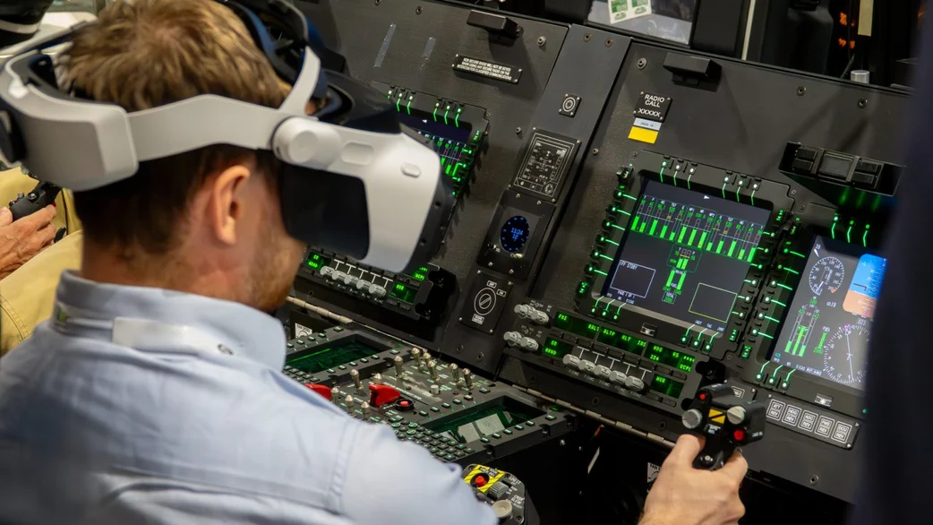
The visual system serves as a core module of Flight Simulation Training Devices (FSTDs). It directly determines training effectiveness for pilot situational awareness and constitutes a key audit item during Level‑D FFS qualification assessments conducted by regulators including EASA, CAAC and FAA. An airworthiness‑compliant visual system must satisfy strict metrics for field‑of‑view, image resolution, refresh rate, day‑night weather simulation, terrain fidelity and dynamic‑object rendering capabilities. Driven by growing demand for both airliner training and commercial UAM/eVTOL low‑altitude simulation, training environments have expanded from conventional trunk‑route airports to complex urban low‑altitude airspace, imposing new requirements on visual‑engine data throughput and 3D‑scene granularity. China Simulation Sciences (CSS)’s in‑house integrated visual‑rendering system supports both traditional civil‑aviation Level‑D full‑flight simulators and next‑generation eVTOL Urban Air Mobility simulation platforms.
Mandatory Technical Requirements for Visual Systems Under the FSTD Qualification Framework
National civil‑aviation authorities establish quantitative visual‑system metrics for high‑grade FSTDs based on ICAO provisions. For Level‑D FFS deployed for aircraft‑type conversion and recurrent‑training qualification, visual hardware and rendering software must pass formal compliance testing. Multiple real‑world projects have experienced delayed certification due to visual‑system non‑conformities identified during site‑acceptance phases.
1. Field‑of‑View, Display Resolution and Pixel Density
Level‑D full‑flight simulators enforce clear minimum thresholds for horizontal and vertical field‑of‑view. Sufficient pixel density shall guarantee clear recognition of distant runway markings and air‑traffic targets. Blurred imagery will cause pilot distance‑judgement bias and degrade training validity.
2. Synchronised Refresh Rate and Motion Latency Control
Image‑rendering latency and frame‑asynchrony may induce visual discomfort for trainees and break consistency between control inputs and vehicle responses. Regulatory specifications define strict end‑to‑end latency thresholds to maintain synchronisation between cockpit manipulations and visual output.
3. All‑Weather Meteorological and Environmental Simulation
The visual system shall replicate diverse illumination and weather conditions: clear sky, layered cloud decks, fog, rain, snow, glare and twilight lighting. Continuous visibility adjustment shall reproduce typical low‑visibility operational scenarios for take‑off, approach and landing phases.
4. Terrain Database Fidelity and Dynamic‑Object Simulation
Geospatial data for runways, taxiways, navigational aids and obstacles shall match real‑world reference information. Simulation of ground vehicles, aircraft and bird activity shall be supported to enable airspace‑conflict‑avoidance training. For UAM use‑cases, high‑fidelity 3D urban‑building databases are additionally required.
Differentiated Visual‑System Requirements for Civil Airliner versus eVTOL Simulation Platforms
Conventional trunk‑route civil‑aviation simulators focus training around standardised airport airspace, emphasising take‑off‑and‑landing manoeuvres, en‑route weather and air‑traffic conflicts. eVTOL‑UAM simulation centres on dense urban environments, requiring large‑scale high‑fidelity building models, visual environments correlated with building‑wake turbulence effects and dynamic rendering of low‑altitude obstacles. Greater demands are placed on geospatial‑model precision and large‑scale urban‑database streaming performance.
Built on a modular architecture, China Simulation Sciences (CSS) visual‑rendering engine enables seamless switching between the two categories of scene databases, lowering capital expenditure for customers operating mixed simulation fleets.
Core Advantages of China Simulation Sciences (CSS) High‑Fidelity Visual System
End‑to‑End Low‑Latency Rendering Architecture
The proprietary rendering engine optimises end‑to‑end data pipelines and tightly controls image transmission and rendering latency to satisfy Level‑D FFS MOC‑8 latency criteria, supporting synchronised operation with six‑degree‑of‑freedom motion platforms.
Compatibility with Global Standard Terrain‑Database Formats
Supports industry‑standard aviation geospatial datasets and global airport databases. For UAM deployments, dedicated high‑precision urban‑3D‑scene authoring tooling enables customers to extend simulated urban airspace coverage on demand.
Comprehensive Library of Weather, Lighting and Special‑Effect Environments
Fully adjustable meteorological modules deliver layered cloud formations, localised fog banks, heavy precipitation and wet‑runway visual effects, covering all typical weather training scenarios defined within civil‑aviation operational regulations.
Open‑API Native Integration With Host Simulation Engine
The visual system natively interfaces with the aircraft‑dynamics simulation engine. Aircraft fault states and attitude variations drive real‑time visual updates. Integration with instructor‑operator stations supports one‑click activation of emergency scenarios for unified training supervision.
Long‑Term Visual‑System Maintenance and Version‑Upgrade Planning
Visual‑system software and terrain databases require regular updates. Airport expansions, newly commissioned vertiports and evolving urban building stock demand iterative refresh of 3D‑scene assets. China Simulation Sciences (CSS) delivers ongoing database‑maintenance services and software feature upgrades to keep visual‑system performance aligned with latest FSTD qualification requirements across the full equipment lifecycle. Customers may adopt phased expansion for display channels and projection‑hardware upgrades to match long‑term business growth roadmaps.
Industry Trend Summary
FSTD qualification requirements for visual fidelity will continue to tighten. Meanwhile UAM‑industry expansion drives visual‑system development toward larger‑area coverage and hyper‑detailed urban‑scene rendering. Visual solutions limited exclusively to airport‑centric scenarios can no longer support diversified business portfolios. Integrated visual platforms capable of supporting both trunk‑route civil‑aviation simulation and urban low‑altitude eVTOL training will become a key consideration during flight‑training‑centre equipment procurement. China Simulation Sciences (CSS) continuously advances visual‑rendering technology and delivers complete multi‑jurisdiction‑compliant visual‑system solutions for global clients.
Frequently Asked Questions
Q1: Will non‑compliant visual‑system performance invalidate Level‑D FFS qualification?
A1: Yes. The visual system constitutes a critical item during on‑site regulatory inspection. Failure to satisfy MOC‑8 metrics for field‑of‑view, latency, resolution or terrain fidelity will block FSTD compliance approval and prevent issuance of valid operational credentials.
Q2: Can one visual system serve both civil‑aviation FFS and eVTOL simulators?
A2: China Simulation Sciences (CSS) modular visual platform supports both device types. Retain base hardware; switch terrain databases and scene‑configuration profiles to adapt the system for trunk‑route airliner training or urban‑air‑mobility eVTOL training respectively.
Q3: Are full hardware replacements required for visual‑terrain‑database updates?
A3: No. Terrain‑scene refreshes are software‑and‑data‑level updates; existing display hardware and rendering servers remain fully functional. Hardware expansion is only necessary when customers seek extended field‑of‑view or higher display resolution.







Comment