Forests are one of the planet’s most powerful natural defenses against climate change. They absorb carbon dioxide, regulate temperatures, protect biodiversity, and stabilize ecosystems. Yet despite their importance, global forests are disappearing at an alarming rate. Deforestation, forest degradation, and climate-driven disturbances such as wildfires and pests are accelerating, placing immense pressure on ecosystems and the industries that depend on them.
In this context, advanced monitoring technologies are becoming essential. Among them, LiDAR, especially when deployed via drones, has emerged as a critical tool in the fight to protect and restore forests.
The Growing Challenge of Deforestation
Deforestation is no longer a distant environmental issue, it is a global crisis with far-reaching consequences. Each year, millions of hectares of forest are lost due to logging, agricultural expansion, urbanization, and infrastructure development. Climate change further amplifies these threats by increasing droughts, heat stress, and extreme weather events.
The risks associated with deforestation include loss of carbon sinks that accelerate global warming, biodiversity collapse and habitat fragmentation, increased flood and landslide risks, disruption of water cycles and soil stability, and economic losses for forestry, agriculture, and local communities.
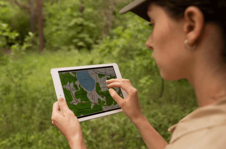
Traditional forest monitoring methods such as ground surveys and satellite imagery often struggle to provide the resolution, accuracy, and frequency needed to respond effectively to these challenges.
Why Monitoring Forests Is So Difficult
Forests are complex, dynamic, and often difficult to access. Dense canopies obscure ground conditions, rugged terrain limits fieldwork, and large geographic areas make frequent surveys costly and time-consuming. Satellite imagery, while valuable, can be affected by cloud cover and may lack the detail required to assess forest structure, biomass, and degradation below the canopy.
These limitations make it difficult for decision-makers to detect early signs of forest stress or measure the true impact of conservation and climate initiatives.
How LiDAR Helps Protect Forests
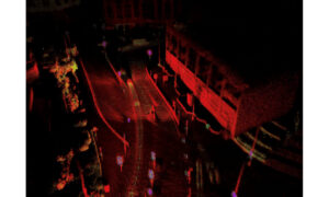
LiDAR, or Light Detection and Ranging, uses laser pulses to measure distances and create detailed three-dimensional representations of landscapes. When mounted on a drone, LiDAR becomes an exceptionally flexible and precise tool for forest monitoring.
A drone equipped with a LiDAR sensor can penetrate dense forest canopies and capture accurate data on both vegetation structure and underlying terrain. This capability is critical for understanding forest health beyond what optical imagery alone can provide.
Key applications in forestry include measuring tree height, canopy density, and forest volume, estimating biomass and carbon stocks, detecting illegal logging and forest degradation, monitoring reforestation and restoration efforts, and mapping terrain for erosion and watershed analysis.
Fighting Climate Change Through Better Forest Data
Forests play a central role in climate change mitigation, but only if they are properly managed and protected. Accurate data is essential for quantifying their contribution to carbon sequestration and for validating climate strategies at local, national, and global levels.
Drone-based LiDAR enables scientists and policymakers to produce reliable carbon inventories, track changes in forest cover over time, validate conservation and reforestation initiatives, and support carbon credit and offset programs with verifiable data.
By reducing uncertainty and improving measurement consistency, LiDAR strengthens the credibility of climate action plans tied to forest protection.
Industries Directly Impacted by Forest Loss
Deforestation affects far more than environmental organizations. Multiple industries rely on healthy forest ecosystems and are increasingly turning to LiDAR technology for data-driven decision-making.
Forestry and timber management depend on accurate assessments of forest structure and growth to support sustainable harvesting and long-term planning. LiDAR enables precision forestry while helping meet environmental compliance requirements.
Energy and infrastructure sectors are influenced by forest conditions through vegetation management, erosion risks, and landslide susceptibility. Drone-based LiDAR supports safer planning and more resilient infrastructure development.
Agriculture and water management are affected by deforestation through disrupted water cycles and soil degradation. LiDAR helps model watersheds, identify erosion risks, and guide sustainable land-use strategies.
Insurance and risk management increasingly rely on high-resolution environmental data to assess exposure to wildfires, floods, and landslides. LiDAR provides the detail needed for more accurate risk modeling.
From Detection to Prevention
One of the most powerful aspects of LiDAR technology is its ability to shift forest management from reactive to proactive. Instead of responding after damage has occurred, organizations can detect early warning signs of degradation, illegal activity, or climate stress.
With regular drone surveys, subtle changes in forest structure can be identified quickly, enabling faster intervention and more effective conservation strategies.
LiDAR technology alone will not stop deforestation or reverse climate change, however it plays a critical role in providing the visibility and accuracy needed to understand what is truly happening within forest ecosystems. By revealing forest structure, biomass distribution, terrain conditions, and subtle changes over time, a drone equipped with a LiDAR sensor enables governments, industries, and conservation organizations to move from assumptions to evidence-based action. Whether the goal is climate mitigation, sustainable forestry, risk management, or ecosystem restoration, reliable data is the foundation of effective decision-making. As pressure on global forests continues to grow, technologies that combine precision, scalability, and efficiency will become indispensable, in that sense, drone-based LiDAR is not just a monitoring tool, it is a key enabler in protecting one of the planet’s most valuable natural assets.