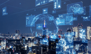
The world is changing, and the way people protect it is evolving faster than ever. Geohazard management and infrastructure protection have entered a new era, driven by digital transformation and technological innovation. Critical infrastructure faces increasing threats from landslides, earthquakes, floods and soil instability. Modern geotechnical engineering relies on real-time data and digital insights to assess risk, design safer structures and minimize human and economic impact.
The need for advanced geohazard management is becoming increasingly urgent. A 2025 report from ADREM, SNSE, NDRC, IFRC, and IRDR estimates that the global cost of natural disasters is escalating, with infrastructure damage representing a significant portion of these expenses.
Digital Twins
At the heart of the current transformation is digital twin technology. These virtual replicas of physical infrastructure allow engineers to simulate structural stress, environmental impact and potential hazards in a risk-free digital environment. Digital twin infrastructure connects to sensors, drones and IoT networks, enabling real-time geohazard monitoring that continuously updates the digital model.
For example, AWS provides guidance on creating digital twins for industrial IoT, spatial compute, and simulation use cases. This involves securely ingesting and managing industrial IoT and spatial assets through comprehensive digital twin dashboards.
This means that engineers can assess bridges, tunnels and slopes for performance under extreme weather or seismic activity before any physical damage occurs. Maintenance becomes predictive rather than reactive, saving millions in emergency repairs and reducing risk to human life.
Smarter Data
Modern geohazard management thrives on data-driven insights. Engineers now collect enormous volumes of geospatial, environmental and structural data through advanced sensors, satellites and UAVs. Predictive modeling can detect patterns invisible to traditional inspections, from subtle soil shifts to early warning signs of landslides. The capability to gather and analyze critical geospatial data efficiently and at scale is transforming the industry, enabling precise mapping and monitoring of at-risk regions.
By harnessing this data, organizations can anticipate potential failures, optimize maintenance schedules and prioritize resources efficiently. This digital revolution ensures that evidence, rather than assumptions, guides infrastructure protection.
Technological Innovations
Key technological innovations drive unprecedented efficiency:
- Predictive analytics and digital monitoring: AI-driven models forecast hazard events before they happen, enabling timely interventions.
- Remote operations technologies: Robotic platforms and remotely controlled machinery allow engineers to operate in hazardous zones without risk of exposure.
- Drones and UAVs: These provide high-resolution imagery and LiDAR mapping. This enables precise environmental monitoring and structural assessment in inaccessible areas.
- IoT sensor networks: Embedded sensors continuously measure soil moisture, structural stress, vibration and other geotechnical engineering parameters.
Environmental Gains
While technology protects infrastructure, it also protects the environment. Drones and geotechnical robotics minimize the need for human intervention in sensitive ecosystems while collecting precise environmental data. This reduces ecological disruption during inspections or emergency responses.
Environmental modeling through digital twin technology helps engineers design resilient infrastructure that respects natural landscapes, prevents erosion and mitigates flood risk. Sustainable practices are embedded in modern geohazard management strategies.
AI and Analytics
Artificial intelligence and predictive analytics play a central role in the modern approach to data analysis. Machine learning algorithms process massive datasets from sensors, drones and historical records to forecast hazards and suggest preventive measures.
This enables data-driven disaster prevention that goes beyond human intuition. By predicting landslides, structural failures or flooding events, AI minimizes economic loss, optimizes emergency response and saves lives. Advanced data analysis and pattern recognition allow engineers to spot emerging trends, detect anomalies and uncover opportunities that might go unnoticed through traditional inspections. Real-time analytics also feed into digital twin infrastructure, ensuring models remain accurate under changing conditions.
Human Impact
The integration of robotics, drones and remote monitoring directly impacts human safety. Engineers can operate machinery from safe locations, thereby reducing their exposure to hazardous conditions. Drone revolutions in environmental monitoring allow teams to inspect cliffs, riverbanks and unstable slopes without stepping into harm’s way.
At the same time, the ROI of digital infrastructure protection is clear. Fewer emergency repairs, extended asset lifespan and predictive maintenance reduce long-term costs while improving community resilience. Beyond economics, it prioritizes human lives.
The Digital Future
The convergence of digital twin technology, AI, predictive analytics, IoT and remote operations is redefining traditional industries. Digital transformation of traditional industries like civil engineering is no longer optional, but essential. By embracing digital tools, organizations achieve safer, more efficient operations. They can anticipate disasters, optimize maintenance, reduce environmental impact and protect critical infrastructure against increasingly volatile geohazards. The future is data-driven, proactive and smarter than ever.
To further enhance safety and efficiency, consider the integration of AI-powered report writing tools. These tools can automate much of the reporting process, significantly reducing the time required to create professional, client-ready documents.