Agrowing Ltd. is a provider of award-winning patented multispectral sensors. They have recently added China to the countries that have approved its “Method for aerial imagery acquisition and analysis” patent. This patent has already been granted in the USA, Japan, Australia, and Euro-Asia. Agrowing’s patent discloses the disruptive concept of shifting from imprecise NDVI remote sensing to “Remote and Close” AI leaf-level agricultural aerial analysis. This analysis is in real-time and near real-time. This concept and method are essential for early-stage detection, identification, and prevention of the spreading and outbursts of pests and diseases in open field crops, orchards, and forests.
Agrowing will soon be looking to license the technology to photogrammetric software vendors and mission planning vendors. These vendors will be looking to enhance their services and provide growers with tools for surveys, which result in immediate and actionable data. The co-founder and CEO of Agrowing, Ira Dvir, has said that, “Agrowing has been preaching its concept of using NDVI and its various agricultural metrics as an initial step towards leaf-level aerial multispectral AI analysis of outlying and normal zones for a few years.” He went on to add that, “With the advance of commercial UAVs, GIS software, and embedded AI processing tools, what seemed unimaginable just five years ago, is already achievable, and will probably be the common practice in the very near future and for many years to come.”
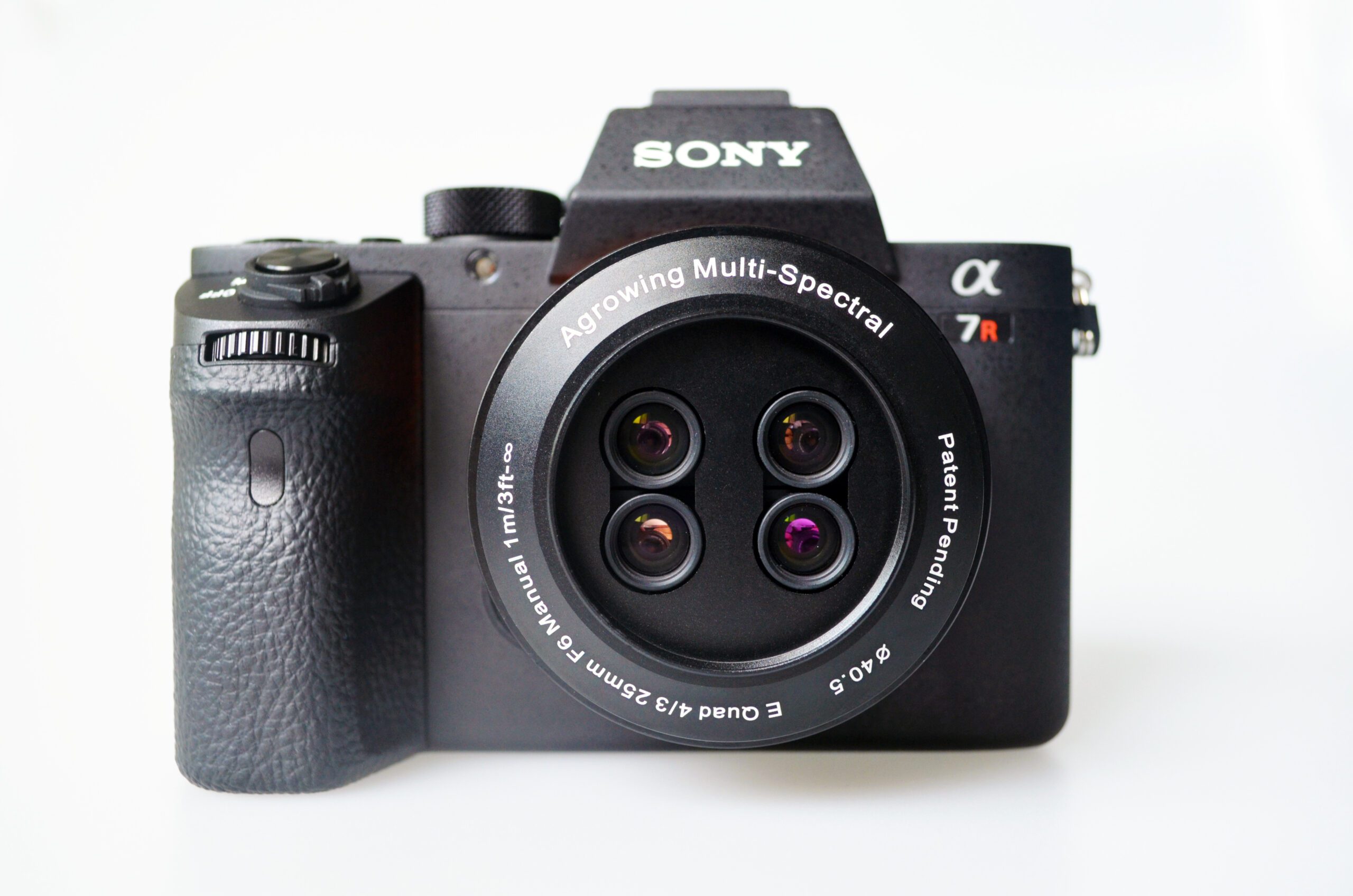
Agrowing’s “Multispectral imaging apparatus” patent discloses Agrowing’s innovative multispectral design of a multi-lens single sensor. This sensor enables commercial deployment of Agrowing’s “Remote and Close” AI leaf-level aerial multispectral sensing. This technology uses Agrowing’s sensors of 4, 10, and 14 narrow spectral bands of 8MP to 12MP per band. Agrowing will also feature 24MP and 42MP per band in the near future. This enables overcoming most of the issues, which are related to multispectral sensors such as synchronization, chroma aberration, parallax, poor resolution, and limited dynamic range. Agrowing’s sensors are capable of multispectral imagery acquisition at sub-0.5mm from as close as 3m above the crop, which enables leaf-level AI analysis. This diminishes the need to send people to the surveyed location to check and/or verify inaccurate assessments.
Agrowing’s sensors were acknowledged by the press panel, which announced it a winning innovative product at the Commercial UAV Expo Americas. The Brazilian VetorGeo announced they would use Agrowing’s Quad lens 10 band sensor for detecting high altitude and leaf-level invisible HLB in Citrus. Jeremiah Karpowicz who is the editorial director of Commercial UAV News wrote that, “Agrowing Ltd. has an established track record when it comes to enabling powerful tools for farmers and growers. The provider of AI-enabling multispectral sensors consistently creates products that set it apart from the competition to enable real opportunities for users.”
Agrowing’s vision is to establish the world’s first Multispectral Imagery Bank of agricultural pests, diseases, and vegetation irregularities. This imagery bank will include leaf-level sub 1 mm per pixel multispectral samples of the phenomena and their distinctive multispectral signatures. Agrowing has already begun gathering this imagery. Agrowing’s “Method for aerial imagery acquisition and analysis” patent discloses a simple and effective way to acquire such multispectral imagery using Agrowing’s sensors.
Agrowing is drastically changing the nature of precision agriculture using high end NDVI maps that are produced by Agrowing’s sensors. These maps act as the pedestal for the company’s innovative patented Remote&Close Sensing. NDVI and similar multispectral metrics and maps have limited value. They provide assessments and estimates, which require manual verification. Agrowing’s Remote&Close Sensing provides the grower with accurate and actionable data. This minimizes and can even eliminate the need for verification.
The unique design of Agrowing’s sensors and their imagery acquisition method, result in the ability to analyze extremely high-resolution multispectral data. This data is collected from outlying areas of interest, as an additional step to their high-end traditional NDVI. These areas are often inaccessible to agronomists. Agrowing’s vision and technologies enable accurate in-the-field automatic machine-vision and machine-learning identification of agricultural hazards like pests, diseases and irregularities like stress and nutrient deficiencies.
This link demonstrates Agrowing’s “Method for aerial imagery acquisition and analysis” patent:
Agrowing was founded with the vision of immediate in-the-field hazards identification. Agrowing Ltd. is a world leading innovative provider of patented award-winning high-end multispectral sensing solutions. Agrowing’s sensors take aerial precision agriculture sensing from the imprecise NDVI to the next higher level of actionable data by enabling leaf-level autonomous AI detection and identification of various vegetation abnormalities.
Media contact: info@agrowing.com

