Digital mapping services and geographic information systems (GIS) are integral to modern spatial data management and analysis, offering various applications from urban planning to environmental conservation.
Digital mapping, also known as cartography, involves creating and using maps in digital formats that facilitate the visualization, analysis, and interpretation of spatial and geographic data across various locations. On the other hand, GIS is a framework that combines powerful software tools with digital mapping capabilities to process data related to locations on the Earth’s surface.
Together, these tools enable leaders to visualize complex spatial information, identify trends and patterns, and make informed decisions based on comprehensive geographic analyses. More importantly, integrating these technologies into everyday applications, such as smartphone navigation apps, online weather services, and business analytics tools, improves people’s relationship with maps, allowing them to discover new places, interact with their peers, and plan their trips.
Drawing on over eight years of experience on several location platforms, the author explores the future of geo-based services and what the industry can anticipate, given the demand for accurate place discovery and the rise of new technologies.
The Dawn of New Technologies
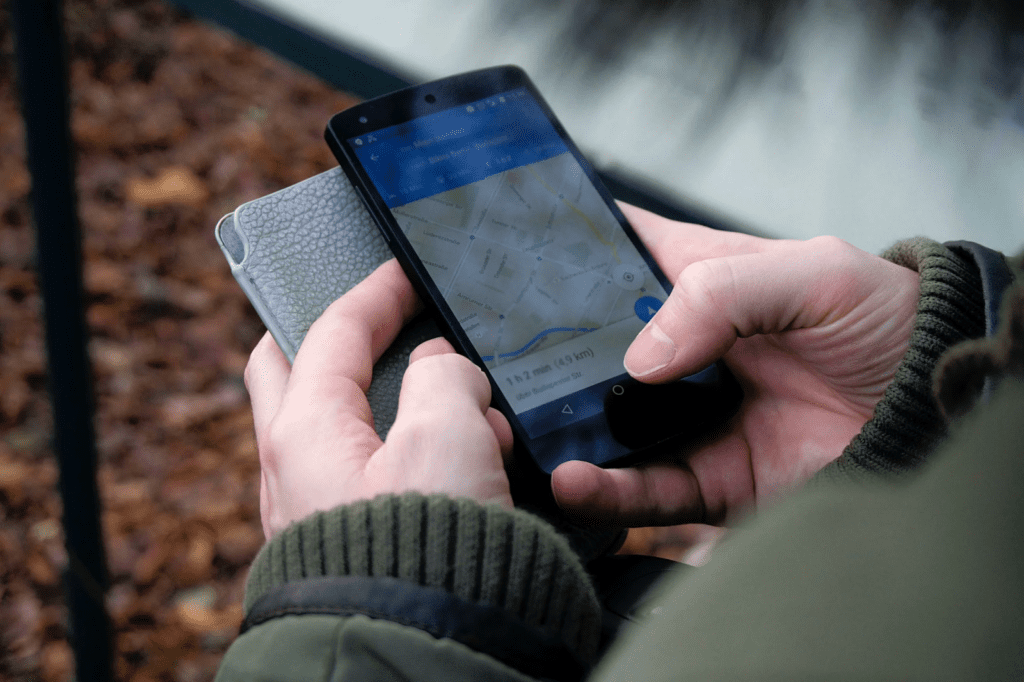
Geo-based services such as digital maps have come a long way since their inception. Today, it encompasses much more than just interactive maps and directions. With more sophisticated technology, mapping software has become a tool that offers advanced features and capabilities. For instance, Snap’s “My Places” lets users discover popular locations and save their favorite places to revisit later. It features 30 million businesses, allows users to log their favorite local spots, and even finds personalized recommendations from friends and other app users.
However, future mapping services are expected to integrate more sophisticated real-time data, factors crucial in discovering or choosing a place to visit. With advancements in artificial intelligence (AI) and machine learning (ML), mapping services could offer hyper-personalized recommendations for finding places. By analyzing user preferences, past behavior, and even current mood or context, these services could suggest unique destinations, attractions, and experiences tailored specifically to users. This personalization would make the discovery process more relevant and exciting, potentially uncovering hidden gems that align perfectly with user interests.
At the same time, the future of mapping services will likely see a significant improvement in 3D mapping and modeling technologies, providing users with highly detailed and accurate representations of places. This could extend beyond simple visualizations, including the ability to interact with 3D models of buildings, landscapes, and urban environments, offering insights into a place’s layout, architecture, and spatial dynamics. Such detailed models could be invaluable for planning visits, architecture, urban planning, and heritage conservation.
Aside from this, augmented reality (AR) and virtual reality (VR) technologies also have the potential to change the way users discover places by offering immersive exploration experiences from the comfort of their homes. Imagine putting on a VR headset and walking through the streets of a city halfway around the world, interacting with the environment in real time, or using a smartphone to overlay historical data or future development plans on a current landscape through AR. All these technologies could provide a more effective and engaging way to learn about and experience new places before physically visiting them.
Going Above and Beyond Place Discovery
With the rise of technology, mapping services will transcend traditional boundaries of place discovery, venturing into features that will significantly empower and transform vital industries.
For instance, in healthcare, integrating advanced mapping technologies and GIS enables real-time tracking of ambulances and patient transportation, ensuring timely medical attention and improving the overall efficiency of emergency services. When combined with health data, this spatial intelligence offers a powerful tool for predicting outbreaks, planning healthcare facilities, and enhancing accessibility to medical services for underserved populations.
In the transportation sector, mapping will facilitate unprecedented efficiency, safety, and sustainability levels. Autonomous vehicles, relying heavily on sophisticated mapping technologies, will transform urban mobility, reducing traffic congestion and minimizing the environmental impact of transportation.
Real-time data integration will allow for dynamic routing, traffic management, and predictive infrastructure maintenance, significantly improving travel reliability and safety. Moreover, mapping services will be crucial in developing smart cities, where interconnected transportation systems can adapt to changing conditions and user demands in real-time.
By providing a deeper understanding of spatial dynamics, future mapping technologies will enhance location discovery, empower other industries to operate more effectively, encourage customers to visit physical stores, and accurately target specific geographic regions, making significant contributions to crucial sectors.
A Future Full of Possibilities
The future of geo-based services is intrinsically linked to the ambitious goal of fostering smart cities, where the convergence of technology, data, and urban infrastructure promises to redefine urban experience. These smart cities envision real-time data analytics and spatial intelligence that informs every aspect of urban living, from optimizing traffic flow and enhancing public safety to reducing environmental footprints and improving public services.
The promise of even greater innovation within these smart urban environments underscores geospatial experts’ commitment to advancing technology and creating more livable, resilient, and inclusive communities for all.
About the Author:
Sushant Wason’s career in geospatial and mapping services companies like Vurb and Snap combines technical prowess and forward-thinking leadership. Based in California, Wason leads a team of software engineers, GIS (Geographic Information System) engineers, and applied data scientists. His team manages geospatial data and develops innovative geo-services and features for Snap Map—a pivotal component of the Snapchat app that engages over 350 million users monthly.
Wason’s tenure at Snap as the Location Platform and Geo-Spatial Data lead has introduced innovative features to Snap Map, including Places, Layers, My Places for Local Discovery, and Place Moderation. These enhancements have personalized and enriched the user experience. Through his contributions, Snap Map has evolved into a more engaging, user-centric platform, offering tailored local discovery options.