Geography is more than maps and capitals. Today’s tools make it hands-on, visual, and playful.
With a mix of games, maps, and simple creation apps, learners can test ideas and see real patterns. Teachers can shape quick checks, then stretch them into deeper projects.
Why Geography Thrives With Tech
Geography connects people, places, and data. Digital tools let students move from a flat page to interactive layers and living maps. That shift keeps attention and helps memory stick.
Tech supports many learning styles. Visual learners see patterns, while hands-on learners explore and build. Even short sessions can deliver rich insights.
Feedback loops are fast. A quiz, a quick map, or a shared gallery can show growth in minutes. That speed keeps motivation high.
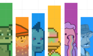
Gamified Drills That Stick
Short, spaced practice helps learners recall names, flags, and features. Well-designed quizzes keep the pace quick and the stakes low. Students try again, notice patterns, and improve.
A playful way to sharpen recall is to mix timed rounds with a light challenge. In one round, you might guess the country flag, and in the next match it to a continent. The rapid feedback makes each attempt feel fresh. Learners turn guesswork into recognition.
Balance matters. Keep sessions short and add variation across rounds. Use mistakes as hints for follow-up study, not as penalties.
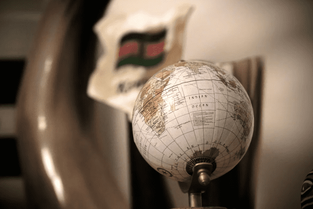
Map Exploration Builds Real Understanding
Interactive maps help students see relationships they cannot get from static images. Layers show climate, population, and land use side by side. With one click, a flat map becomes a story.
Students can compare two regions and pose questions. Why do cities line up along rivers here but not there? How do mountains shape the weather on each side?
A recent open-access study reported that a mix of simple digital tools expanded access for learners who were limited by place or time, and it highlighted how structured activities support long-term skill growth. That insight supports using maps for repeated practice, not just one-off demos.
Visual Patterns Make Facts Memorable
When learners spot a pattern, they remember the fact that reveals it. Tech helps by turning numbers into shapes and colors. A heat map, a dot map, or a time slider can turn noise into a clear signal.
Patterns invite simple claims. Rainfall rises along this coast. Farms cluster near this plateau. Clear visuals reduce guessing and build confidence.
Teach students to check patterns with a second layer. If a pattern holds when the data changes, it is more likely real. That habit is core to good geographic thinking.
Short Projects That Grow Skills
Mini-projects transform scattered facts into a storyline. A class might track where the foods in their lunch come from, then map the journey. Another group could chart daily weather and compare it with a regional forecast.
Keep projects focused and time-boxed. A tight scope lowers stress and raises completion. Students learn to define questions, collect data, and share results.
Use simple rubrics with 3 to 4 criteria. Clarity, accuracy, relevance, and reflection are enough. Students can self-check before sharing.
Practical Ways To Blend Tools
It helps to pair one discovery tool with one practice tool. This keeps cognitive load low and routines clear. Students know when they are exploring and when they are quizzing.
Try a weekly flow that cycles through explore, practice, and reflect. Exploration introduces a new idea. Practice secures recall. Reflection cements what worked and why.
Consider quick, concrete moves like:
- Rotate 2 quiz modes per week
- Add 1 new map layer per topic
- End each session with a 3-sentence reflection
Data, Place, And Culture Together
Good geography links facts to people and stories. Tech can enrich that link with photos, short clips, and voice notes. Students hear local voices and see daily life.
Place-based tasks make content real. Map the school’s walking routes, then mark safe crossings. Compare the class’s commute times with bus lines and bike paths.
Keep culture central. Ask how borders, language, and history shape a region’s map. Invite students to bring examples from home and connect them to themes.
Assessments That Inform, Not Intimidate
Formative checks work best when they are quick and clear. A small quiz, a labeled map, or a 1-minute audio note can show understanding. Students see where to focus next.
Rubrics should highlight growth. Did the student use evidence? Did the map match the claim? Did the reflection explain a choice?
Summaries help teachers spot trends. If many miss the same layer or symbol, reteach that skill. Small course corrections keep the class moving together.

Learning geography is easier when tools are simple and goals are clear. Mix short drills with hands-on maps, and let students talk through what they see.
Keep it light, repeat key moves, and celebrate steady progress. With that routine, modern tech turns the world into a readable map.
Read More From Techbullion