In an increasingly digital and spatially connected world, immersive 3D experiences are no longer a luxury—they’re a necessity. Real estate, architecture, construction, tourism, and cultural preservation are just a few of the many industries embracing virtual technology to visualize, interact with, and market physical spaces. At the core of this transformation is LiDAR (Light Detection and Ranging), a laser-based measurement technology that has evolved into a powerful tool for building precise 3D representations of real environments.
Whether you’re creating a digital twin of a luxury apartment or scanning a centuries-old monument, LiDAR is enabling faster, more accurate, and more accessible 3D capture than ever before. In this article, we’ll explore how LiDAR works, what makes it unique, and why it’s driving a new era of 3D virtual tours and spatial modeling.
What Is LiDAR and How Does It Work?
LiDAR is a remote sensing method that uses rapid laser pulses to measure distances between the scanner and the environment. Each pulse reflects off surfaces and returns to the sensor, which calculates distance based on the time it takes for the light to travel. The result is a “point cloud”—a dense collection of 3D data points that together form a highly accurate spatial map.
Unlike traditional photogrammetry, which uses 2D images stitched together to infer depth, LiDAR captures precise geometric information directly. This makes it extremely useful in areas where texture is minimal (such as white walls), light is inconsistent (like dim basements), or measurement accuracy is mission-critical.
Key advantages of LiDAR:
- Sub-centimeter accuracy in most conditions
- Speed : captures millions of points in seconds
- Lighting independence : works in bright sunlight or complete darkness
- Scalability : effective for both small rooms and entire outdoor landscapes
Real Estate: LiDAR-Powered Virtual Tours Are Changing the Game
The real estate industry has embraced 3D virtual tours to meet evolving buyer expectations. Clients increasingly want the ability to tour homes remotely before visiting in person, and agents need to market listings faster, more efficiently, and more interactively.
LiDAR-based 3D scanning enables the creation of immersive walkthroughs that outperform basic photography or video:
- To-scale models help buyers assess room dimensions and spatial flow
- Accurate floor plans and measurements speed up decision-making
- 3D integration with websites and mobile apps provides rich, self-guided tours
Using LiDAR also benefits multi-unit housing developments and commercial real estate. Investors can assess large spaces without traveling, and developers can showcase properties while still under construction—thanks to virtual renderings built on LiDAR-accurate measurements.

Architecture and Design: A Foundation Built on Precision
For architects and interior designers, every detail counts. From ceiling heights to window spacing, exact dimensions are the bedrock of a successful design. LiDAR simplifies the process of gathering those measurements by digitizing a space in minutes.
Use cases include:
- As-built documentation before renovation or retrofitting
- BIM (Building Information Modeling) integration for construction planning
- Visual overlays to compare existing structures with proposed changes
- Collaboration across teams using shared cloud-based models
Traditional methods like tape measuring or handheld laser scanning are time-consuming and prone to human error. LiDAR ensures accuracy from the start—saving both time and money down the road.
Museums, Heritage Sites, and Tourism: Preserving the Past Digitally
LiDAR isn’t just for sales and design. It’s also playing a vital role in cultural preservation . Historical buildings, religious monuments, and archeological sites can be scanned and preserved digitally—often with far greater detail than photography allows.
Museums and universities now use LiDAR to:
- Create interactive digital exhibitions
- Document sites vulnerable to natural disaster or urban development
- Enable remote education and tourism without risking physical damage
- Collaborate internationally on restoration efforts using shared 3D models
From ancient ruins to modern landmarks, LiDAR ensures we can study, restore, and experience the past in ways never before possible.

Industrial Applications: LiDAR Goes Beyond Aesthetics
LiDAR also powers real-world operations. In construction, facility management, and infrastructure planning, accurate 3D models are critical for:
- Clash detection in structural planning
- Monitoring construction progress vs. plan
- Inspecting hard-to-reach or hazardous areas safely
- Managing space utilization in factories and warehouses
The scalability of LiDAR—from a handheld scanner in a room to a drone flying over a construction site—makes it one of the most flexible tools in industrial digitalization.
Comparing LiDAR with Photogrammetry
While both technologies aim to capture the 3D shape of an environment, LiDAR and photogrammetry differ in process, precision, and use cases.
| Feature | LiDAR | Photogrammetry |
|---|---|---|
| Accuracy | High (±1–3cm) | Medium (±5–10cm) |
| Speed | Fast (1–10 mins/scan) | Slower (requires many photos) |
| Light Requirements | Works in any light | Requires consistent lighting |
| Surface Detail | Good with flat/textured walls | Better with complex textures |
| Cost | Higher (special hardware) | Lower (camera-based) |
| Learning Curve | Moderate | Low to moderate |
For critical applications—such as digital twins, construction workflows, and immersive property marketing—LiDAR typically outperforms photogrammetry.
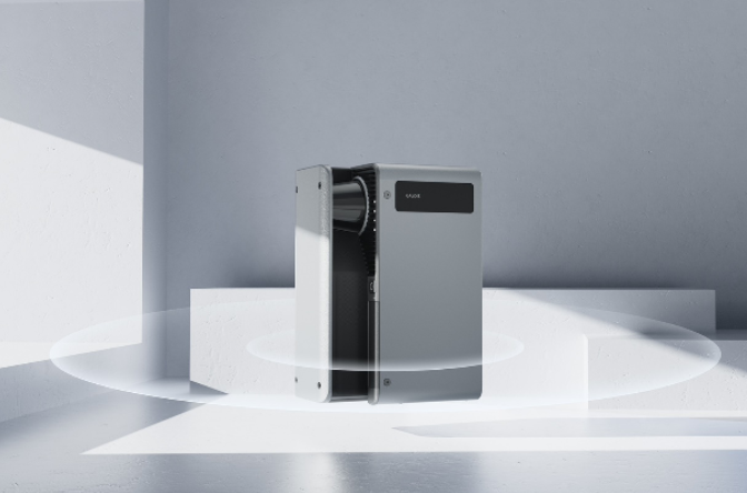
From Tripods to Tablets: The Evolution of LiDAR Devices
As LiDAR becomes more commercially available, hardware options have exploded. Previously, LiDAR was limited to heavy, expensive tripod setups used by surveyors and geologists. Today, you can find LiDAR in drones, mobile scanners, and even smartphones.
A modern LiDAR camera can be as compact as a phone module, delivering real-time scanning capabilities for casual users and professionals alike. High-end solutions still provide unmatched accuracy for architectural-grade projects, but portable systems are closing the gap fast—especially when paired with cloud-based software platforms that streamline stitching, editing, and sharing of 3D models.

LiDAR in Smart Cities and Digital Twins
One of the most exciting frontiers for LiDAR is in the creation of digital twins —virtual replicas of buildings, cities, or assets that are updated in real-time. These models are used to simulate operations, plan maintenance, optimize energy use, and improve public safety.
Examples include:
- Smart lighting and HVAC based on LiDAR occupancy tracking
- Emergency evacuation modeling
- Urban planning using full-city 3D models
- Asset management for utilities and infrastructure
As 5G and edge computing expand, LiDAR will become a core sensor technology for real-time spatial computing—bridging the gap between physical and digital worlds.
Future Outlook: Where Is LiDAR Heading?
The future of LiDAR is bright—and not just because it uses lasers.
We can expect:
- Smaller, cheaper, and more energy-efficient devices
- AI-enhanced processing for automated 3D model generation
- Wider integration into mobile apps, AR/VR tools, and smart home platforms
- Interoperability with IoT devices, BIM software, and cloud ecosystems
With every advance, LiDAR becomes less of a specialized tool and more of a standard component of how we interact with the built environment.
Conclusion
LiDAR has come a long way—from niche scientific instrument to essential digital tool. Whether you’re scanning a room, digitizing a historic cathedral, or building a high-tech smart building, LiDAR offers the precision, speed, and scalability that modern professionals demand.
As industries across the board embrace virtual technology, the ability to capture real-world spaces accurately and efficiently is no longer optional—it’s a competitive necessity. With solutions ranging from handheld devices to industrial-grade systems, the LiDAR revolution is well underway.